Three of us decided to try out the Penpych walk at the top of the Rhondda Fawr, with a view to doing it as a club walk.
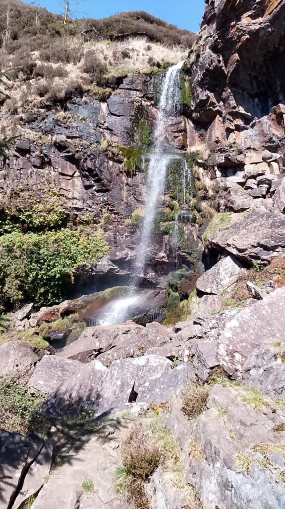
The zig zag path out of the car park was easy to follow, eventually turning quite stony. We were overtaken by a couple, the girl wearing flip flops. She’ll regret that. We soon came to the first waterfall. The track up to it was pretty rough and we got so far then decided that was near enough. The girl in the flip flops went on up the track and down the other side, rough stones and all, to the bottom of the fall. We complimented her!
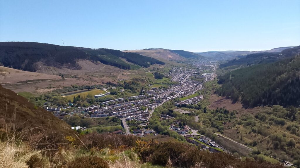
The path took us on up a steep rocky climb to the top of the mountain where there were spectacular views over Blaencwm, Treherbert and on down the valley. The Man Utd flag was a memorial to a football fan. The drop over the cliff edge was a near vertical 100 feet and more with a strong wind blowing up it. We had been warned in the car park about someone taking photos who got blown over the edge and we could quite believe it. At a stone wall we took a wrong turning and did a mile or so in the wrong direction (it was a recce after all) but on the way back to the wall a few big stones by a small waterfall were a good place for our picnic.
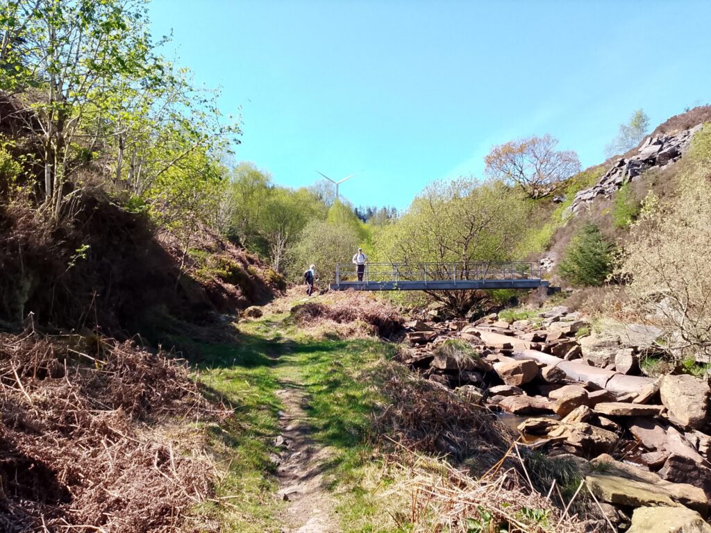
The right route then went on down another stony path, eventually through woodland to a bridge over the River Rhondda. The large pipes in the river bed seemed a bit superfluous. On up another rough track then to another bridge and a short distance further to a largeish pond, obviously artificial as it was held in by concrete wall. Don’t know what it would have been for. Derek described the view of the “stunning Nant Melyn waterfall” and so it looked, but it was way off in the distance and that was the closest we got. We now lost contact with Derek who told us to “head uphill through the valley” although what valley was not clear and there were no obvious tracks anywhere. Eventually we scrambled through and under small trees up to a vague sheep track, over a fallen stone wall then onto a hillside looking back down the Rhondda. This was just heather and dead bracken, extremely hard to walk through and over especially as the ground underneath was rough. Two sheep, the only ones we saw all day, watched us as we slip slid down over the bracken. We could see the Rhigos road in the distance so that was some orientation guide.
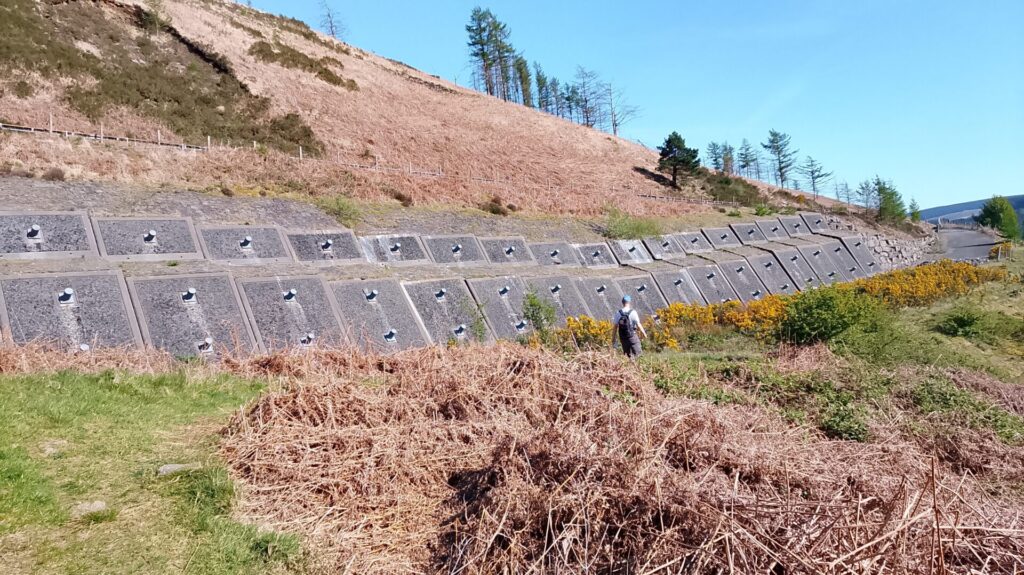
Eventually we found Derek’s route again, this time paddling uphill once more through a stream running down the hill until we came to his “rock cut steps”, pretty steep. At the top of this hill we could see the path heading up to the highest point of the Rhigos road. Just before reaching the road we turned back down the valley on an obvious path but never found the stone age settlement somewhere nearby. Then sadly we lost touch with Derek again. After passing some enormous concrete washers and steel Rawlplugs holding up the road we had to get onto it. We should have been further down the hillside somewhere, who know how we should have got there. Anyway pretty soon there was a track off to the right, not on any maps, going down towards some houses, presumably the edge of Blaencwm. It was better than the road so we took it. This mystery trip took us down passing someone’s back garden hedge until we got to a wrought iron fence. Squeezing through a gap where one upright was missing, fortunately, we came to another high fence on a small industrial estate but just went round the end of it (what is the point of a fence like that?) and onto a road and civilisation. It was just a road walk then of a mile or so back to the car. The consensus of Komoot and OS was that the distance was about 10 miles. Climb I don’t know but pretty hard in places anyway.
We thought it might do for a challenging U3A walk but would need to sort out the bits where we lost contact with Derek. C- for clarity of instructions, we thought but quite an adventure anyway.